

Mapping Mountains - Summit Relocations - Y Trichant
Allt yr Hafod (SN 668 442) - 35th summit relocation
Significant Name Changes post for Allt yr Hafod
There has been a Summit Relocation to a hill that is listed in the Y Trichant – The 300m Hills of Wales, with the summit height, bwlch height and their locations, the drop and status of the hill derived from detail on contemporary maps produced from Ordnance Survey data and LIDAR analysis conducted by Myrddyn Phillips.
%20-%20LIDAR%20summit%201.jpg) |
| LIDAR image of Allt yr Hafod (SN 668 442) |
 |
| Y Trichant - The 300m Hills of Wales by Myrddyn Phillips |
%20IMG_9869A%20-%201%2025000.jpg) |
| Extract from the Ordnance Survey 1:25,000 Explorer map |
%20-%20LIDAR%20summit%203.jpg) |
| LIDAR summit image of Allt yr Hafod (SN 668 442) |
%20-%20LIDAR%20summit%205.jpg) |
| LIDAR close up summit image of Allt yr Hafod (SN 668 442) |
The full details for the hill are:
Group: Esgair Wen
Name: Allt yr Hafod
OS 1:50,000 map: 146
Summit Height: 310.2m (LIDAR)
Summit Grid Reference (New Position): SN 66859 44201 (LIDAR)
Bwlch Height: c 288m (interpolation)
Bwlch Grid Reference: SN 67104 44293 (interpolation)
Drop: c 22m (LIDAR summit and interpolated bwlch)
Myrddyn Phillips (April 2023)
Mapping Mountains - Summit Relocations - Y Trichant
Lan Ystenu (SN 960 532) - 34th summit relocation
There has been a Summit Relocation to a hill that is listed in the Y Trichant – The 300m Hills of Wales, with the summit height, bwlch height and their locations, the drop and status of the hill derived from LIDAR analysis conducted by Myrddyn Phillips.
%20-%20LIDAR%20hill%203.jpg) |
| LIDAR image of Lan Ystenu (SN 960 532) |
 |
| Y Trichant - The 300m Hills of Wales by Myrddyn Phillips |
%20IMG_9712A%20-%201%2025000.jpg) |
| Extract from the Ordnance Survey 1:25,000 Explorer map |
%20-%20LIDAR%20summit%201.jpg) |
| LIDAR summit image of Lan Ystenu (SN 960 532) |
The full details for the hill are:
Group: Drygarn Fawr
Name: Lan Ystenu
OS 1:50,000 map: 147
Summit Height: 329.9m (LIDAR)
Summit Grid Reference (New Position): SN 96089 53229 (LIDAR)
Bwlch Height: 271.2m (LIDAR)
Bwlch Grid Reference: SN 95950 53655 (LIDAR)
Drop: 58.7m (LIDAR)
Myrddyn Phillips (March 2023)
Mapping Mountains - Summit Relocations - Y Trichant
Cefn Isaf (SN 800 486) - 33rd summit relocation
Significant Height Revisions post for Cefn Isaf
There has been a Summit Relocation to a hill that is listed in the Y Trichant – The 300m Hills of Wales, with the summit height, bwlch height and their locations, the drop and status of the hill derived from LIDAR analysis conducted by Myrddyn Phillips.
%20-%20LIDAR%20hill%202.jpg) |
| LIDAR image of Cefn Isaf (SN 800 486) |
 |
| Y Trichant - The 300m Hills of Wales by Myrddyn Phillips |
%20IMG_9637A%20-%201%2025000.jpg) |
| Extract from the Ordnance Survey 1:25,000 Explorer map |
%20-%20LIDAR%20hill%203.jpg) |
| LIDAR summit image of Cefn Isaf (SN 800 486) |
The full details for the hill are:
Group: Drygarn Fawr
Name: Cefn Isaf
OS 1:50,000 map: 147
Summit Height: 386.0m (LIDAR)
Summit Grid Reference (New Position): SN 80031 48623 (LIDAR)
Bwlch Height: 345.5m (LIDAR)
Bwlch Grid Reference: SN 80361 48591 (LIDAR)
Drop: 40.5m (LIDAR)
Myrddyn Phillips (March 2023)
Mapping Mountains - Summit Relocations - Y Trichant
Graig Orddle (SN 998 935) - 32nd summit relocation
There has been a Summit Relocation to a hill that is listed in the Y Trichant – The 300m Hills of Wales, with the summit height, bwlch height and their locations, the drop and status of the hill derived from LIDAR analysis conducted by Myrddyn Phillips.
%20-%20LIDAR%20hill%201.jpg) |
| LIDAR image of Graig Orddle (SN 998 935) |
 |
| Y Trichant - The 300m Hills of Wales by Myrddyn Phillips |
%20IMG_2305A%20-%201%2025000.jpg) |
| Extract from the Ordnance Survey 1:25,000 Explorer map |
%20-%20LIDAR%20summit%201.jpg) |
| LIDAR image of Foel y Belan (SN 994 933) and Graig Orddle (SN 998 935) |
The full details for the hill are:
Group: Pumlumon
Name: Graig Orddle
OS 1:50,000 map: 136
Summit Height: 351.8m (LIDAR)
Summit Grid Reference: SN 99841 93587 (LIDAR)
Bwlch Height: 272.8m (LIDAR)
Bwlch Grid Reference: SN 98777 93951 (LIDAR)
Drop: 79.0m (LIDAR)
Myrddyn Phillips (November 2022)
Mapping Mountains - Summit Relocations - Y Trichant
Mynydd Llanfair (SJ 038 040) - 31st summit relocation
Hill Reclassifications post for Mynydd Llanfair
Significant Name Changes post for Mynydd Llanfair
There has been a Summit Relocation to a hill that is listed in the Y Trichant – The 300m Hills of Wales, with the summit height, bwlch height and their locations, the drop and status of the hill derived from LIDAR analysis conducted by Myrddyn Phillips.
%20-%20LIDAR%20hill%203.jpg) |
| LIDAR image of Mynydd Llanfair (SJ 038 040) |
 |
| Y Trichant - The 300m Hills of Wales by Myrddyn Phillips |
%20IMG_2074A%20-%201%2025000.jpg) |
| Extract from the Ordnance Survey 1:25,000 Explorer map |
%20-%20LIDAR%20hill%201.jpg) |
| LIDAR summit image of Mynydd Llanfair (SJ 038 040) |
The full details for the hill are:
Group: Carnedd Wen
Name: Mynydd Llanfair
OS 1:50,000 map: 136
Summit Height: 373.7m (LIDAR)
Summit Grid Reference: SJ 03809 04011 (LIDAR)
Bwlch Height: 351.9m (LIDAR)
Bwlch Grid Reference: SJ 03291 04027 (LIDAR)
Drop: 21.8m (LIDAR)
Myrddyn Phillips (October 2022)
Mapping Mountains - Summit Relocations - Y Trichant
Cefn Gwyn (SO 028 995) - 30th summit relocation
Hill Reclassifications post for Cefn Gwyn
Significant Name Changes post for Cefn Gwyn
There has been a Summit Relocation to a hill that is listed in the Y Trichant – The 300m Hills of Wales, with the summit height, bwlch height and their locations, the drop and status of the hill derived from LIDAR analysis conducted by Myrddyn Phillips.
%20-%20LIDAR%20hill%202.jpg) |
| LIDAR image of Cefn Gwyn (SO 028 995) |
 |
| Y Trichant - The 300m Hills of Wales by Myrddyn Phillips |
%20IMG_1970A%20-%201%2025000.jpg) |
| Extract from the Ordnance Survey 1:25,000 Explorer map |
%20-%20LIDAR%20summit%201.jpg) |
| LIDAR summit image of Cefn Gwyn (SO 028 995) |
The full details for the hill are:
Group: Carnedd Wen
Name: Cefn Gwyn
OS 1:50,000 map: 136
Summit Height: 382.7m (LIDAR)
Summit Grid Reference (New Position): SO 02813 99573 (LIDAR)
Bwlch Height: 362.0m (LIDAR)
Bwlch Grid Reference: SO 02633 99303 (LIDAR)
Drop: 20.6m (LIDAR)
Myrddyn Phillips (October 2022)
Mapping Mountains - Summit Relocations - Y Trichant
Pt. 333.2m (SJ 091 161) - 29th summit relocation
Significant Name Changes post for Pt. 333.2m
There has been a Summit Relocation to a hill that is listed in the Y Trichant – The 300m Hills of Wales, with the summit height, bwlch height and their location, the drop and status of the hill confirmed by LIDAR analysis conducted by Myrddyn Phillips.
%20-%20LIDAR%20hill%201.jpg) |
| LIDAR image of Pt. 333.2m (SJ 091 161) |
 |
| Y Trichant - The 300m Hills of Wales by Myrddyn Phillips |
%20-%201%2050000.jpg) |
| Extract from the Ordnance Survey 1:50,000 Landranger map |
%20-%20LIDAR%20summit%202.jpg) |
| LIDAR summit image of Pt. 333.2m (SJ 091 161) |
The full details for the hill are:
Group: Foel Cedig
Name: Pt. 333.2m
OS 1:50,000 map: 125
Summit Height: 333.2m (LIDAR)
Summit Grid Reference (New Position): SJ 09191 16165 (LIDAR)
Bwlch Height: 305.3m (LIDAR)
Bwlch Grid Reference: SJ 09266 16570 (LIDAR)
Drop: 27.8m (LIDAR)
Myrddyn Phillips (August 2022)
Mapping Mountains - Summit Relocations - Y Trichant
Banc Cwm Coed Ifor (SN 594 385) - 28th summit relocation
There has been a Summit Relocation to a hill that is listed in the Y Trichant – The 300m Hills of Wales and Y Trechol – The Dominant Hills of Wales, with the summit height, bwlch height and their locations, the drop, dominance and status of the hill derived from LIDAR analysis conducted by Myrddyn Phillips.
%20-%20LIDAR%20hill%203.jpg) |
| LIDAR image of Banc Cwm Coed Ifor (SN 594 385) |
 |
| Y Trichant - The 300m Hills of Wales by Myrddyn Phillips |
 |
| Y Trechol - The Dominant Hills of Wales by Myrddyn Phillips |
%20IMG_0402A%20-%201%2025000.jpg) |
| Extract from the Ordnance Survey 1:25,000 Explorer map |
%20-%20LIDAR%20summit%202.jpg) |
| LIDAR summit image of Banc Cwm Coed Ifor (SN 594 385) |
The full details for the hill are:
Group: Mynydd Pencarreg
Name: Banc Cwm Coed Ifor
OS 1:50,000 map: 146
Summit Height: 308.1m (LIDAR)
Summit Grid Reference (New Position): SN 59407 38541 (LIDAR)
Bwlch Height: 196.6m (LIDAR)
Bwlch Grid Reference: SN 58001 39509 (LIDAR)
Drop: 111.5m (LIDAR)
Dominance: 36.19% (LIDAR)
Myrddyn Phillips (June 2022)
Mapping Mountains - Summit Relocations - Y Trichant
Lan Ddu Cilwenau (SN 572 371) - 27th summit reloocation
Significant Height Revisions post for Lan Ddu Cilwenau
Significant Name Changes post for Lan Ddu Cilwenau
There has been a Summit Relocation to a hill that is listed in the Y Trichant – The 300m Hills of Wales and Y Trechol – The Dominant Hills of Wales, with the summit height, bwlch height and their locations, the drop, dominance and status of the hill derived from detail on contemporary maps produced from Ordnance Survey data and LIDAR analysis conducted by Myrddyn Phillips.
%20-%20LIDAR%20hill%202.jpg) |
| LIDAR image of Lan Ddu Cilwenau (SN 572 371) |
 |
| Y Trichant - The 300m Hills of Wales by Myrddyn Phillips |
 |
| Y Trechol - The Dominant Hills of Wales by Myrddyn Phillips |
%20IMG_0418A%20-%201%2025000.jpg) |
| Extract from the Ordnance Survey 1:25,000 Explorer map |
%20-%20LIDAR%20summit%202.jpg) |
| LIDAR summit image of Lan Ddu Cilwenau (SN 572 371) |
The full details for the hill are:
Group: Mynydd Pencarreg
Name: Lan Ddu Cilwenau
OS 1:50,000 map: 146
Summit Height: 333.1m (LIDAR)
Summit Grid Reference (New Position): SN 57277 37147 (LIDAR)
Bwlch Height: c 211m (interpolation)
Bwlch Grid Reference: SN 56467 37617 (interpolation)
Drop: c 122m (LIDAR summit and interpolated bwlch)
Dominance: 36.66% (LIDAR summit and interpolated bwlch)
Myrddyn Phillips (May 2022)
Mapping Mountains - Summit Relocations - Y Trichant
Mynydd Cefn Ddwy Graig (SH 936 340) - 26th summit relocation
There has been a Summit Relocation to a hill that is listed in the Y Trichant – The 300m Hills of Wales, with the summit height, bwlch height and their location, the drop and status of the hill confirmed by LIDAR analysis conducted by Myrddyn Phillips.
 |
| LIDAR image of Mynydd Cefn Ddwy Graig (SH 936 340) |
 |
| Y Trichant - The 300m Hills of Wales by Myrddyn Phillips |
 |
| Extract from the Ordnance Survey 1:25,000 Explorer map |
 |
| LIDAR summit image of Mynydd Cefn Ddwy Graig (SH 936 340) |
The full details for the hill are:
Group: Esgeiriau Gwynion
Name: Mynydd Cefn Ddwy Graig
OS 1:50,000 map: 125
Summit Height: 346.4m (LIDAR)
Summit Grid Reference (New Position): SH 93620 34020 (LIDAR)
Bwlch Height: 317.8m (LIDAR)
Bwlch Grid Reference: SH 93117 33669 (LIDAR)
Drop: 28.55m (LIDAR)
Myrddyn Phillips (May 2022)
Mapping Mountains - Summit Relocations - Y Trichant
Foel Fawr (SH 679 057) - 25th summit relocation
Significant Height Revisions post for Foel Fawr
There has been a Summit Relocation to a hill that is listed in the Y Trichant – The 300m Hills of Wales, with the summit height, bwlch height and their location, the drop and status of the hill derived from LIDAR analysis conducted by Myrddyn Phillips.
 |
| LIDAR image of Foel Fawr (SH 679 057) |
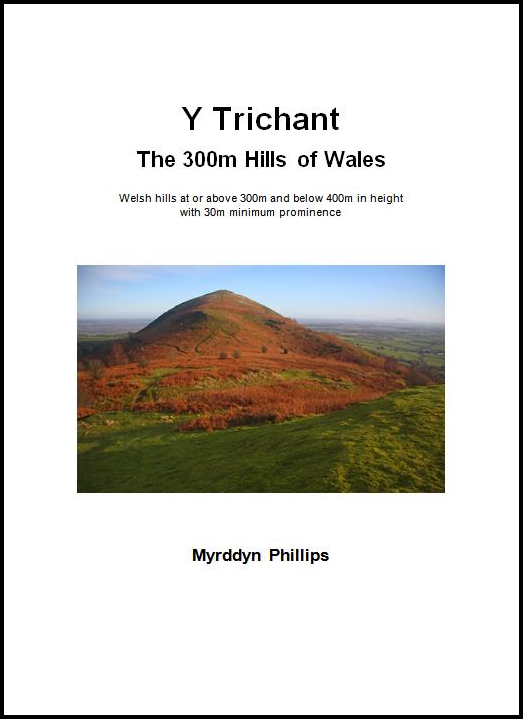
Y Trichant – The 300m Hills of Wales – Welsh hills at or above 300m and below 400m in height that have 30m minimum drop, with an accompanying sub list entitled the Sub-Trichant, with the criteria for this sub category being all Welsh hills at or above 300m and below 400m in height with 20m or more and below 30m of drop. The list is authored by Myrddyn Phillips with the Introduction to the list and the renaming of it appearing on Mapping Mountains on the 13th May 2017, and the Introduction to the Mapping Mountains publication of the list appearing on the 1st January 2022.
 |
| Y Trichant - The 300m Hills of Wales by Myrddyn Phillips |
When the original 300m height band of Welsh P30 hills were published on Geoff Crowder’s v-g.me website, this hill was listed with a 348m summit height, based on the spot height that appears on the Ordnance Survey 1:50,000 Landranger and 1:25,000 Explorer map and which is positioned at SH 67959 05849.
 |
| Extract from the Ordnance Survey 1:25,000 Explorer map |
 |
| LIDAR summit image of Foel Fawr (SH 679 057) |
The term Summit Relocations applies to when the high point is positioned in a different field, to a different feature such as a conifer plantation, within a different map contour, a different point where a number of potential summit positions are within close proximity, when natural ground or the natural and intact summit is confirmed compared to a higher point such as a raised field boundary or covered reservoir that is considered a relatively recent man-made construct, or a relocation of approximately 100 metres or more in distance from either the position of a map spot height or from where the summit of the hill was previously thought to exist.
Therefore, the summit height produced by LIDAR analysis is 343.9m and this is positioned at SH 67982 05743, this position is not given a spot height on the contemporary Ordnance Survey 1:50,000 Landranger and 1:25,000 Explorer map, and is approximately 110 metres southward from where the previously listed summit is positioned.
The full details for the hill are:
Group: Tarren y Gesail
Name: Foel Fawr
OS 1:50,000 map: 124
Summit Height: 343.9m (LIDAR)
Summit Grid Reference (New Position): SH 67982 05743 (LIDAR)
Bwlch Height: 286.5m (LIDAR)
Bwlch Grid Reference: SH 67651 05532 (LIDAR)
Drop: 57.4m (LIDAR)
Myrddyn Phillips (March 2022)
Mapping Mountains - Summit Relocations - Y Trichant
Mynydd Du (SH 805 084) - 24th summit relocation
Hill Reclassifications post for Mynydd Du
There has been a Summit Relocation to a hill that is listed in the Y Trichant – The 300m Hills of Wales, with the summit height, bwlch height and their location, the drop and status of the hill derived from LIDAR analysis conducted by Myrddyn Phillips.
 |
| LIDAR image of Mynydd Du (SH 805 084) |
Y Trichant – The 300m Hills of Wales – Welsh hills at or above 300m and below 400m in height that have 30m minimum drop, with an accompanying sub list entitled the Sub-Trichant, with the criteria for this sub category being all Welsh hills at or above 300m and below 400m in height with 20m or more and below 30m of drop. The list is authored by Myrddyn Phillips with the Introduction to the list and the renaming of it appearing on Mapping Mountains on the 13th May 2017, and the Introduction to the Mapping Mountains publication of the list appearing on the 1st January 2022.
 |
| Y Trichant - The 300m Hills of Wales by Myrddyn Phillips |
When the original 300m height band of Welsh P30 hills were published on Geoff Crowder’s v-g.me website, this hill was not included in the Hills to be surveyed sub list, as it was considered not to meet the criteria then used for this sub category.
 |
| Extract from the Ordnance Survey 1:25,000 Explorer map |
 |
| Extract from the Ordnance Survey 1:50,000 Landranger map |
 |
| LIDAR summit image of Mynydd Du (SH 805 084) |
The term Summit Relocations applies to when the high point is positioned in a different field, to a different feature such as a conifer plantation, within a different map contour, a different point where a number of potential summit positions are within close proximity, when natural ground or the natural and intact summit is confirmed compared to a higher point such as a raised field boundary or covered reservoir that is considered a relatively recent man-made construct, or a relocation of approximately 100 metres or more in distance from either the position of a map spot height or from where the summit of the hill was previously thought to exist.
Therefore, the listed summit height of this hill is 335.8m and its new position is SH 80572 08424, this position is not given a spot height on the contemporary Ordnance Survey 1:50,000 Landranger and 1:25,000 Explorer map, and is approximately 100 metres north-eastward from where the previously listed summit is positioned.
The full details for the hill are:
Group: Aran Fawddwy
Name: Mynydd Du
OS 1:50,000 map: 124, 125
Summit Height: 335.8m (LIDAR)
Summit Grid Reference (New Position): SH 80572 08424 (LIDAR)
Bwlch Height: 314.9m (LIDAR)
Bwlch Grid Reference: SH 80738 08624 (LIDAR)
Drop: 20.9m (LIDAR)
Myrddyn Phillips (February 2022)
Mapping Mountains - Summit Relocations - Y Trichant
Y Llan Wern Fawr (SN 893 300) - 23rd summit relocation
Significant Name Changes post for Y Llan Wern Fawr
There has been a Summit Relocation to a hill that is listed in the Y Trichant – The 300m Hills of Wales, with the summit height, bwlch height and their location, the drop and status of the hill derived from LIDAR analysis conducted by Myrddyn Phillips.
 |
| LIDAR image of Y Llan Wern Fawr (SN 893 300) |
Y Trichant – The 300m Hills of Wales – Welsh hills at or above 300m and below 400m in height that have 30m minimum drop, with an accompanying sub list entitled the Sub-Trichant, with the criteria for this sub category being all Welsh hills at or above 300m and below 400m in height with 20m or more and below 30m of drop. The list is authored by Myrddyn Phillips with the Introduction to the list and the renaming of it appearing on Mapping Mountains on the 13th May 2017, and the Introduction to the Mapping Mountains publication of the list appearing on the 1st January 2022.
 |
| Y Trichant - The 300m Hills of Wales by Myrddyn Phillips |
When the original 300m height band of Welsh P30 hills was published on Geoff Crowder’s v-g.me website, this hill was listed with an estimated c 350m summit height based on the small uppermost ring contour that appears on the contemporary Ordnance Survey 1:25,000 Explorer map.
 |
| Extract from the Ordnance Survey 1:25,000 Explorer map |
 |
| LIDAR summit image of Y Llan Wern Fawr (SN 893 300) |
The term Summit Relocations applies to when the high point is positioned in a different field, to a different feature such as a conifer plantation, within a different map contour, a different point where a number of potential summit positions are within close proximity, when natural ground or the natural and intact summit is confirmed compared to a higher point such as a raised field boundary or covered reservoir that is considered a relatively recent man-made construct, or a relocation of approximately 100 metres or more in distance from either the position of a map spot height or from where the summit of the hill was previously thought to exist.
Therefore, the summit height produced by LIDAR analysis is 350.0m and this is positioned at SN 89305 30085, this position is to the remaining natural summit of the hill and is not given a spot height on the contemporary Ordnance Survey 1:50,000 Landranger and 1:25,000 Explorer map, and is approximately 10 metres from where LIDAR indicates the slightly higher raised field boundary to be positioned.
The full details for the hill are:
Group: Mynydd Epynt
Name: Y Llan Wern Fawr
OS 1:50,000 map: 160
Summit Height: 350.0m (LIDAR)
Summit Grid Reference (New Position): SN 89305 30085 (LIDAR)
Bwlch Height: 318.0m (LIDAR)
Bwlch Grid Reference: SN 89043 30577 (LIDAR)
Drop: 32.1m (LIDAR)
Myrddyn Phillips (February 2022)
Mapping Mountains - Summit Relocations - Y Trichant
Pt. 353.6m (SJ 249 539) - 22nd summit relocation
Hill Reclassifications post for Pt. 353.6m
Significant Name Changes post for Pt. 353.6m
There has been a Summit Relocation to a hill that is listed in the Y Trichant – The 300m Hills of Wales, with the summit height, bwlch height and their location, the drop and status of the hill derived from detail on contemporary maps produced from Ordnance Survey data and from LIDAR analysis and a subsequent Trimble GeoXH 6000 survey conducted by Myrddyn Phillips.
 |
| Pt. 353.6m (SJ 249 539) |
Y Trichant- The 300m Hills of Wales – Welsh hills at or above 300m and below 400m in height that have 30m minimum drop, with an accompanying sub list entitled the Sub-Trichant with the criteria for this sub category being all Welsh hills at or above 300m and below 400m in height with 20m or more and below 30m of drop. The list is authored by Myrddyn Phillips, with the Introduction to the list and the renaming of it appearing on Mapping Mountains on the 13th May 2017.
 |
| Y Trichant - The 300m Hills of Wales by Myrddyn Phillips |
 |
| Extract from the Ordnance Survey 1:25,000 Explorer map |
 |
| Extract from the Ordnance Survey series of Six-Inch maps |
However, it was not until LIDAR became available that the details for this hill could be accurately re-assessed. The LIDAR (Light Detection & Ranging) technique produced highly accurate height data that is now freely available for much of England and Wales.
 |
| LIDAR image of Pt. 353.6m (SJ 249 539) |
The term Summit Relocations applies to when the high point is positioned in a different field, to a different feature such as a conifer plantation, within a different map contour, a different point where a number of potential summit positions are within close proximity, when natural ground or the natural and intact summit is confirmed compared to a higher point such as a raised field boundary or covered reservoir that is considered a relatively recent man-made construct, or a relocation of approximately 100 metres or more in distance from either the position of a map spot height or from where the summit of the hill was previously thought to exist.
 |
| The Trimble GeoXH 6000 gathering data at the summit of Pt. 353.6m |
The full details for the hill are:
Group: Moel y Gamelin
Name: Pt. 353.6m
OS 1:50,000 map: 117
Summit Height: 353.6m (converted to OSGM15, Trimble GeoXH 6000)
Summit Grid Reference (New Position): SJ 24997 53989 (Trimble GeoXH 6000)
Bwlch Height: c 322m (interpolation)
Bwlch Grid Reference: SJ 24041 53999 (interpolation)
Drop: c 32m (Trimble GeoXH 6000 summit and interpolated bwlch)
Myrddyn Phillips (November 2021)
Mapping Mountains - Summit Relocations - Y Trichant
Pen Aran Hill (SO 137 888) - 21st summit relocation
Significant Name Changes post for Pen Aran Hill
There has been a Summit Relocation to a hill that is listed in the Y Trichant – The 300m Hills of Wales, with the summit height, bwlch height and their locations, the drop and status of the hill derived from LIDAR analysis and a subsequent Trimble GeoXH 6000 survey conducted by Myrddyn Phillips.
 |
| Pen Aran Hill (SO 137 888) |
Y Trichant- The 300m Hills of Wales – Welsh hills at or above 300m and below 400m in height that have 30m minimum drop, with an accompanying sub list entitled the Sub-Trichant with the criteria for this sub category being all Welsh hills at or above 300m and below 400m in height with 20m or more and below 30m of drop. The list is authored by Myrddyn Phillips, with the Introduction to the list and the renaming of it appearing on Mapping Mountains on the 13th May 2017.
 |
| Y Trichant - The 300m Hills of Wales by Myrddyn Phillips |
 |
| Extract from the Ordnance Survey 1:50,000 Landranger map |
 |
| Extract from the Ordnance Survey 1:25,000 Explorer map |
 |
| LIDAR summit image of Pen Aran Hill |
367.818m at SO 13829 89079
367.819m at SO 13711 88853
These two tops and an intermediary third top were surveyed with the Trimble GeoXH 6000, resulting in the following heights and positions:
367.942m at SO 13828 89079
367.252m at SO 13754 88924
368.031m at SO 13710 88852
As the summit has now been surveyed with the Trimble GeoXH 6000 it is this result that is being prioritised for listing purposes, and this comes within the parameters of the Summit Relocations used within this page heading, these parameters are:
The term Summit Relocations applies to when the high point is positioned in a different field, to a different feature such as a conifer plantation, within a different map contour, a different point where a number of potential summit positions are within close proximity, when natural ground or the natural and intact summit is confirmed compared to a higher point such as a raised field boundary or covered reservoir that is considered a relatively recent man-made construct, or a relocation of approximately 100 metres or more in distance from either the position of a map spot height or from where the summit of the hill was previously thought to exist.
 |
| The Trimble GeoXH 6000 gathering data at the old summit position of Pen Aran Hill |
 |
| The Trimble GeoXH 6000 gathering data at the new summit position of Pen Aran Hill |
The full details for the hill are:
Group: Cilfaesty
Name: Pen Aran Hill
OS 1:50,000 map: 136
Summit Height: 368.0m (converted to OSGM15, Trimble GeoXH 6000)
Summit Grid Reference (New Position): SO 13710 88852 (Trimble GeoXH 6000)
Bwlch Height: 324.6m (LIDAR)
Bwlch Grid Reference: SO 13561 88411 (LIDAR)
Drop: 43.4m (Trimble GeoXH 6000 summit and LIDAR bwlch)
Myrddyn Phillips (October 2021)
Mapping Mountains - Summit Relocations - Y Trichant
Pen y Bryn Mawr (SN 705 732) - 20th summit relocation
Survey post for Pen y Bryn Mawr
There has been confirmation of a Summit Relocation to a hill that is listed in the Y Trichant – The 300m Hills of Wales and Y Trechol – The Dominant Hills of Wales, with the summit height, bwlch height and their locations, the drop, dominance and status of the hill derived from LIDAR analysis conducted by Myrddyn Phillips.
 |
| The forested summit of Pen y Bryn Mawr (SN 705 732) |
Y Trichant- The 300m Hills of Wales – Welsh hills at or above 300m and below 400m in height that have 30m minimum drop, with an accompanying sub list entitled the Sub-Trichant with the criteria for this sub category being all Welsh hills at or above 300m and below 400m in height with 20m or more and below 30m of drop. The list is authored by Myrddyn Phillips, with the Introduction to the list and the renaming of it appearing on Mapping Mountains on the 13th May 2017.
 |
| Y Trichant - The 300m Hills of Wales by Myrddyn Phillips |
 |
| Y Trechol - The Dominant Hills of Wales by Myrddyn Phillips |
When the original 300m height band of Welsh P30 hills was published on Geoff Crowder’s v-g.me website, this hill was listed under the name of Cefn Blewog with a 341m summit height based on the spot height that appears on the Ordnance Survey 1:25,000 Explorer map and which is positioned at SN 70556 72711.
 |
| Extract from the Ordnance Survey 1:25,000 Explorer map |
The details of this hill were later re-examined and its summit position relocated to Pen y Bryn Mawr, this hill is due north of Cefn Blewog and although it does not possess a summit spot height on contemporary Ordnance Survey 1:50,000 Landranger and 1:25,000 Explorer maps, its uppermost 340m ring contour is larger than that given Cefn Blewog and therefore Pen y Bryn Mawr was listed with an estimated c 342m summit height, and when coupled with an emended c 224m bwlch height, these values gave Pen y Bryn Mawr an estimated c 118m of drop and 34.50% dominance.
 |
| LIDAR image of Pen y Bryn Mawr (SN 705 732) and Cefn Blewog (SN 705 727) |
The summit height produced by LIDAR analysis for these two hills is given below:
341.619m at SN 70567 73222 for Pen y Bryn Mawr
340.660m at SN 70552 72709 for Cefn Blewog
This comes within the parameters of the Summit Relocations used within this page heading, these parameters are:
The term Summit Relocations applies when the hill’s high point is found to be positioned; in a different field, within a different map contour, to a different feature such as in a conifer plantation, to a different point where a number of potential summit positions are within close proximity, a relocation of approximately 100 metres or more in distance from either the position of a map spot height or from where the summit of the hill was previously thought to exist, or when natural ground or the natural and intact summit is confirmed compared to a higher point such as a raised field boundary that is judged to be a relatively recent man-made construct.
 |
| The Trimble GeoXH 6000 at the summit of Pen y Bryn Mawr |
The full details for the hill are:
Group: Elenydd
Name: Pen y Bryn Mawr
OS 1:50,000 map: 135, 147
Summit Height: 341.6m (LIDAR)
Summit Grid Reference (New Position): SN 70567 73222 (LIDAR)
Bwlch Height: 222.8m (LIDAR)
Bwlch Grid Reference: SN 72170 73551 (LIDAR)
Drop: 118.8m (LIDAR)
Dominance: 34.77% (LIDAR)
Myrddyn Phillips (September 2021)
Mapping Mountains - Summit Relocations - Y Trichant
Mynydd Tŷ’r Sais (SH 855 004) - 19th summit relocation
Survey post for Mynydd Tŷ’r Sais
Hill Reclassifications post for Mynydd Tŷ’r Sais
Significant Height Revisions post for Mynydd Tŷ’r Sais
There has been a Summit Relocation to a hill that is listed in the Y Trichant – The 300m Hills of Wales, with the summit height, bwlch height and their locations, the drop and status of the hill confirmed by a Trimble GeoXH 6000 survey, prompted by an enquiry from Ronnie Bowron based on detail in the summit analysis programme produced by Joe Nuttall.
 |
| Mynydd Tŷ'r Sais (SH 855 004) |
Y Trichant- The 300m Hills of Wales – Welsh hills at or above 300m and below 400m in height that have 30m minimum drop, with an accompanying sub list entitled the Sub-Trichant with the criteria for this sub category being all Welsh hills at or above 300m and below 400m in height with 20m or more and below 30m of drop. The list is authored by Myrddyn Phillips, with the Introduction to the list and the renaming of it appearing on Mapping Mountains on the 13th May 2017.
 |
| Y Trichant - The 300m Hills of Wales by Myrddyn Phillips |
When the original 300m height band of Welsh P30 hills was published on Geoff Crowder’s v-g.me website, this hill was not included in the Hills to be surveyed sub list, as it was considered not to meet the criteria then used for this sub category.
After the sub list was standardised, and interpolated heights and drop values also included the details for this hill were re-evaluated and it was listed with 26m of drop, based on the 359m summit spot height positioned at SH 85453 00439 that appears on the Ordnance Survey 1:50,000 Landranger and the 1:25,000 Explorer map and the 333m bwlch spot height that appeared on the Ordnance Survey Vector Map Local hosted on the Geograph website and which was entitled the Interactive Coverage Map.
 |
| Extract from the Ordnance Survey 1:25,000 Explorer map |
One of the resources now available online is the mapping on the OS Maps website. This is the replacement for OS Get-a-map and until recent times had contours at 5m intervals which were proving consistently more accurate compared to the 5m contours that sometimes appear on the Ordnance Survey 1:25,000 Explorer map and used to appear on the online Vector Map Local. This mapping shows an uppermost 360m ring contour and bwlch contouring much nearer the 330m height when compared to the contouring on the Ordnance Survey 1:25,000 Explorer map.
Another resource now available online is the mapping on the WalkLakes website which hosts an interactive map originated from the Ordnance Survey Open Data programme. This map has many spot heights not on other publicly available Ordnance Survey maps and for this hill a 362m spot height is given on the area of its summit and again the bwlch contouring is much nearer the 330m height when compared to the contouring on the Ordnance Survey 1:25,000 Explorer map.
 |
| Extract from the WalkLakes website |
The term Summit Relocations applies when the hill’s high point is found to be positioned; in a different field, to a different feature such as in a conifer plantation, placed within a different map contour, to a different point where a number of potential summit positions are within close proximity, or when natural ground or the natural and intact summit of a hill is confirmed compared to a higher point such as a raised field boundary that is judged to be a relatively recent man-made construct, or a relocation of approximately 100 metres or more in distance from either the position of a map spot height or from where the summit of the hill was previously thought to exist.
 |
| The Trimble GeoXH 6000 gathering data at the summit of Mynydd Tŷ'r Sais |
The full details for the hill are:
Group: Pumlumon
Name: Mynydd Tŷ’r Sais
OS 1:50,000 map: 135, 136
Summit Height: 362.2m (converted to OSGM15)
Summit Grid Reference (New Position): SH 85514 00483
Bwlch Height: 329.9m (converted to OSGM15)
Bwlch Grid Reference: SH 86220 00690
Drop: 32.2m
Myrddyn Phillips (July 2021)
Mapping Mountains - Summit Relocations - Y Trichant
Top Field (SJ 070 055) - 18th summit relocation
Hill Reclassifications post for Top Field
Significant Name Changes post for Top Field
There has been confirmation of a summit position whose details can be included as a Summit Relocation to a hill that is listed in the Y Trichant – The 300m Hills of Wales, with the summit height, bwlch height and their locations, the drop and status of the hill confirmed by LIDAR analysis and a subsequent Trimble GeoXH 6000 survey conducted by Myrddyn Phillips.
 |
| Top Field (SJ 070 055) |
Y Trichant- The 300m Hills of Wales – Welsh hills at or above 300m and below 400m in height that have 30m minimum drop, with an accompanying sub list entitled the Sub-Trichant with the criteria for this sub category being all Welsh hills at or above 300m and below 400m in height with 20m or more and below 30m of drop. The list is authored by Myrddyn Phillips, with the Introduction to the list and the renaming of it appearing on Mapping Mountains on the 13th May 2017.
 |
| Y Trichant - The 300m Hills of Wales by Myrddyn Phillips |
When the original 300m height band of Welsh P30 hills was published on Geoff Crowder’s v-g.me website, this hill was included in the Hills to be surveyed sub list that accompanied the main P30 list, as it was considered not to meet the criteria then used for the main P30 category.
When the P30 lists were standardised, and interpolated heights and drop values also included, this hill was listed with an estimated c 32m of drop based on the 335m summit spot height positioned at SJ 07085 05586 and an estimated c 303m bwlch height based on interpolation of 10m contouring that appear on the Ordnance Survey 1:25,000 Explorer map.
 |
| Extract from the Ordnance Survey 1:25,000 Explorer map |
 |
| LIDAR image of Top Field (SJ 070 055) |
The result for each position is given below:
Natural summit: 333.257m at SJ 07082 05572
Man-made elevated mound: 333.339m at SJ 07203 05559
The result produced by LIDAR analysis gives this hill a summit height of 333.1m, and as the natural summit has now been surveyed with the Trimble GeoXH 6000 it is this result that is being prioritised for listing purposes and this comes within the parameters of the Summit Relocations used within this page heading, these parameters are:
The term Summit Relocations applies when the hill’s high point is found to be positioned; in a different field, to a different feature such as in a conifer plantation, placed within a different map contour, to a different point where a number of potential summit positions are within close proximity, or when natural ground or the natural and intact summit of a hill is confirmed compared to a higher point such as a raised field boundary that is judged to be a relatively recent man-made construct, or a relocation of approximately 100 metres or more in distance from either the position of a map spot height or from where the summit of the hill was previously thought to exist.
 |
| Gathering data with the Trimble GeoXH 6000 at the natural summit of Top Field |
 |
| Gathering data with the Trimble GeoXH 6000 at the man-made mound |
The full details for the hill are:
Group: Carnedd Wen
Name: Top Field
OS 1:50,000 map: 125
Summit Height: 333.3m (converted to OSGM15, Trimble GeoXH 6000)
Summit Grid Reference (Confirmed Position): SJ 07082 05572 (Trimble GeoXH 6000)
Bwlch Height: 301.1m (LIDAR)
Bwlch Grid Reference: SJ 06237 05273 (LIDAR)
Drop: 32.2m (Trimble GeoXH 6000 summit and LIDAR bwlch)
Myrddyn Phillips (March 2021)
Mapping Mountains - Summit Relocations - Y Trichant
Y Dduallt (ST 041 961) - 17th summit relocation
Hill Reclassifications post for Y Dduallt
Significant Height Revisions post for Y Dduallt
There has been a Summit Relocation to a hill that is listed in the Y Trichant – The 300m Hills of Wales, with the summit height, bwlch height and their locations, the drop and status of the hill derived by Joe Nuttall who produced a summit analysis programme using LIDAR, and then by LIDAR analysis initially conducted by Jim Bloomer and subsequently by Myrddyn Phillips.
 |
| LIDAR image of Y Dduallt (ST 041 961) |
Y Trichant- The 300m Hills of Wales – Welsh hills at or above 300m and below 400m in height that have 30m minimum drop, with an accompanying sub list entitled the Sub-Trichant with the criteria for this sub category being all Welsh hills at or above 300m and below 400m in height with 20m or more and below 30m of drop. The list is authored by Myrddyn Phillips, with the Introduction to the list and the renaming of it appearing on Mapping Mountains on the 13th May 2017.
 |
| Y Trichant - The 300m Hills of Wales by Myrddyn Phillips |
When the original 300m height band of Welsh P30 hills was published on Geoff Crowder’s v-g.me website, this hill was not included in the Hills to be surveyed sub list that accompanied the main P30 list, as it was considered not to meet the criteria then used for this sub category.
After the P30 lists were standardised, and interpolated heights and drop values also included, this hill was listed with 21m of drop based on the 354m summit spot height positioned at ST 04088 96112 and the 333m bwlch spot height that appear on the Ordnance Survey 1:25,000 Explorer map. With its adjacent hill positioned at ST 036 958 listed with an estimated c 360m summit height based on the uppermost ring contour that appears on the Ordnance Survey 1:50,000 Landranger and 1:25,000 Explorer map.
 |
| Extract from the Ordnance Survey 1:25,000 Explorer map |
Both summits have now been analysed via LIDAR. The summit height produced by LIDAR analysis for this hill is 363.0m positioned at ST 04179 96153, as this is higher than the 361.4m adjacent summit positioned at ST 03647 95811, their respective bylchau are swapped. The revised summit position for this hill comes within the parameters of the Summit Relocations used within this page heading, these parameters are:
The term Summit Relocations applies when the hill’s high point is found to be positioned; in a different field, to a different feature such as in a conifer plantation, placed within a different map contour, to a different point where a number of potential summit positions are within close proximity, or when natural ground or the natural and intact summit of a hill is confirmed compared to a higher point such as a raised field boundary that is judged to be a relatively recent man-made construct, or a relocation of approximately 100 metres or more in distance from either the position of a map spot height or from where the summit of the hill was previously thought to exist.
Therefore, the listed summit height of this hill is 363.0m and its new position is ST 04179 96153, this position is not given a spot height on contemporary Ordnance Survey maps and is approximately 100 metres north-eastward from where the previously listed summit is positioned.
The full details for the hill are:
Group: Cymoedd Morgannwg
Name: Y Dduallt
OS 1:50,000 map: 170
Summit Height: 363.0m (LIDAR)
Summit Grid Reference (New Position): ST 04179 96153 (LIDAR)
Bwlch Height: 312.2m (LIDAR)
Bwlch Grid Reference: ST 03283 95733 (LIDAR)
Drop: 50.8m (LIDAR)
Myrddyn Phillips (January 2021)
Mapping Mountains - Summit Relocations - Y Trichant
Blaen Pathiog (SN 927 820) - 16th summit relocation
Hill Reclassifications post for Blaen Pathiog
Significant Height Revisions post for Blaen Pathiog
There has been a Summit Relocation to a hill that is listed in the Y Trichant – The 300m Hills of Wales, with the summit height, bwlch height and their locations, the drop and status of the hill derived from LIDAR analysis and a subsequent Trimble GeoXH 6000 survey conducted by Myrddyn Phillips.
 |
| LIDAR image of Blaen Pathiog (SN 927 820) |
Y Trichant- The 300m Hills of Wales – Welsh hills at or above 300m and below 400m in height that have 30m minimum drop, with an accompanying sub list entitled the Sub-Trichant with the criteria for this sub category being all Welsh hills at or above 300m and below 400m in height with 20m or more and below 30m of drop. The list is authored by Myrddyn Phillips, with the Introduction to the list and the renaming of it appearing on Mapping Mountains on the 13th May 2017.
 |
| Y Trichant - The 300m Hills of Wales by Myrddyn Phillips |
When the original 300m height band of Welsh P30 hills was published on Geoff Crowder’s v-g.me website, this hill was included in the Hills to be surveyed sub list that accompanied the main P30 list, as it was considered not to meet the criteria then used for the main P30 category, and listed with a 377m summit height, based on the spot height that appears on the Ordnance Survey 1:25,000 Explorer map.
 |
| Extract from the Ordnance Survey 1:25,000 Explorer map |
 |
| Extract from the Magic Maps website |
 |
| LIDAR summit image of Blaen Pathiog |
 |
| The Trimble GeoXH 6000 gathering data at the summit of Blaen Pathiog |
The full details for the hill are:
Group: Pumlumon
Name: Blaen Pathiog
OS 1:50,000 map: 136
Summit Height: 376.3m
(converted to OSGM15, Trimble GeoXH 6000)
Summit Grid Reference (New Position): SN 92775 82001 (Trimble GeoXH 6000)
Bwlch Height: 343.3m (LIDAR)
Bwlch Grid Reference:
SN 92760 81765 (LIDAR)
Drop: 33.1m (Trimble GeoXH 6000 summit and LIDAR bwlch)
Myrddyn Phillips (January 2021)
 |
| Mynydd Derw Llwydion (SN 904 900) |
Y Trichant- The 300m Hills of Wales – Welsh hills at or above 300m and below 400m in height that have 30m minimum drop, with an accompanying sub list entitled the Sub-Trichant with the criteria for this sub category being all Welsh hills at or above 300m and below 400m in height with 20m or more and below 30m of drop. The list is authored by Myrddyn Phillips, with the Introduction to the list and the renaming of it appearing on Mapping Mountains on the 13th May 2017.
 |
| Y Trichant - The 300m Hills of Wales by Myrddyn Phillips |
 |
| Extract from the Ordnance Survey 1:25,000 Explorer map |
 |
| Gathering data during the first summit survey of this hill |
 |
| LIDAR image of Mynydd Derw Llwydion |
 |
| Gathering data during the second summit survey of this hill |
 |
| LIDAR image of Cefn Twrch (SN 899 317) |
Y Trichant- The 300m Hills of Wales – Welsh hills at or above 300m and below 400m in height that have 30m minimum drop, with an accompanying sub list entitled the Sub-Trichant with the criteria for this sub category being all Welsh hills at or above 300m and below 400m in height with 20m or more and below 30m of drop. The list is authored by Myrddyn Phillips, with the Introduction to the list and the renaming of it appearing on Mapping Mountains on the 13th May 2017.
 |
| Y Trichant - The 300m Hills of Wales by Myrddyn Phillips |
 |
| Extract from the Ordnance Survey 1:25,000 Explorer map |
 |
| LIDAR summit image for Cefn Twrch |
Banc y Gorlan (SH 922 037) and Cerrig y Tân (SH 917 039) - 13th summit relocation
Y Trichant- The 300m Hills of Wales – Welsh hills at or above 300m and below 400m in height that have 30m minimum drop, with an accompanying sub list entitled the Sub-Trichant with the criteria for this sub category being all Welsh hills at or above 300m and below 400m in height with 20m or more and below 30m of drop. The list is authored by Myrddyn Phillips, with the Introduction to the list and the renaming of it appearing on Mapping Mountains on the 13th May 2017.
 |
| Y Trichant - The 300m Hills of Wales by Myrddyn Phillips |
 |
| Y Pedwarau - The 400m Hills of Wales by Myrddyn Phillips and Aled Williams |
The prioritised name the hill is listed by is Banc y Gorlan with the new twin summit listed as Cerrig y Tân, and it is adjoined to the Carnedd Wen group of hills which are situated in the southern part of North Wales (Region A, Sub-Region A4), and it is positioned with minor roads to its west and east, and the A470 road to its south, and has the village of Llanbrynmair towards the south-west.
 |
| Extract from the Ordnance Survey 1:25,000 Explorer map |
 |
| Extract from the Ordnance Survey series of Six-Inch maps |
 |
| Extract from the WalkLakes website |
Mapping Mountains - Summit Relocations - Y Trichant
Cefn Uchaf (SJ 012 461) - 12th summit relocation
Hill Reclassifications post for Cefn Uchaf
Significant Name Changes post for Cefn Uchaf
Significant Height Revisions post for Cefn Uchaf
 |
| LIDAR image of Cefn Uchaf (SJ 012 461) |
Y Trichant- The 300m Hills of Wales – Welsh hills at or above 300m and below 400m in height that have 30m minimum drop, with an accompanying sub list entitled the Sub-Trichant with the criteria for this sub category being all Welsh hills at or above 300m and below 400m in height with 20m or more and below 30m of drop. The list is authored by Myrddyn Phillips, with the Introduction to the list and the renaming of it appearing on Mapping Mountains on the 13th May 2017.
 |
| Extract from the Ordnance Survey 1:25,000 Explorer map |
 |
| LIDAR summit image of Cefn Uchaf |
Wenlli (SH 845 655) - 11th summit relocation
Significant Name Changes post for Wenlli
Hill Reclassifications post for Wenlli
 |
| LIDAR image of Wenlli (SH 845 655) |
Y Trichant- The 300m Hills of Wales – Welsh hills at or above 300m and below 400m in height that have 30m minimum drop, with an accompanying sub list entitled the Sub-Trichant with the criteria for this sub category being all Welsh hills at or above 300m and below 400m in height with 20m or more and below 30m of drop. The list is authored by Myrddyn Phillips, with the Introduction to the list and the renaming of it appearing on Mapping Mountains on the 13th May 2017.
 |
| Extract from the Ordnance Survey 1:25,000 Explorer map |
Yr Allt (SO 196 358) - 10th summit relocation
Hill Reclassifications post for Yr Allt
Significant Name Changes post for Yr Allt
 |
| LIDAR image of Yr Allt (SO 196 358) |
Y Trichant- The 300m Hills of Wales – Welsh hills at or above 300m and below 400m in height that have 30m minimum drop, with an accompanying sub list entitled the Sub-Trichant with the criteria for this sub category being all Welsh hills at or above 300m and below 400m in height with 20m or more and below 30m of drop. The list is authored by Myrddyn Phillips, with the Introduction to the list and the renaming of it appearing on Mapping Mountains on the 13th May 2017.
 |
| Extract from the Ordnance Survey 1:25,000 Explorer map |
 |
| Extract from the series of Ordnance Survey Six-Inch maps |
 |
| LIDAR summit image for Yr Allt |
 |
| Close up LIDAR summit image for Yr Allt |
Mapping Mountains - Summit Relocations - Y Trichant
Fforest (SN 944 900) - 9th summit relocation
 |
| LIDAR image of Fforest (SN 944 900) |
Y Pedwarau – The 400m Hills of Wales. Welsh hills at or above 400m and below 500m in height that have 30m minimum drop, accompanying the main Y Pedwarau list are five categories of sub hills, with this summit relocation applying to a hill listed in the 390m Sub-Pedwar category, with the criteria for this sub category being all Welsh hills at or above 390m and below 400m in height that have a minimum 30m of drop. The list is co-authored by Myrddyn Phillips and Aled Williams, with the Introduction to the Mapping Mountains publication of this list appearing on the 30th January 2017, and the list is now available in its entirety on Mapping Mountains in Google Doc format.
When the original 300m height band of Welsh P30 hills were published on Geoff Crowder’s v-g.me website the summit height of this hill was listed as 391m which was based on the spot height positioned at SN 94301 90124 that appears on the Ordnance Survey 1:25,000 Explorer map.
 |
| Extract from the Ordnance Survey 1:25,000 Explorer map |
 |
| LIDAR bwlch image for Fforest |
Bwlch Grid Reference: SN 93945 89099 (LIDAR)
Mapping Mountains - Summit Relocations - Y Trichant
Y Foel (SJ 026 407) - 8th summit relocation
 |
| LIDAR summit image of Y Foel (SJ 026 407) |
Y Pedwarau - Welsh hills at or above 400m and below 500m in height that have 30m minimum drop. Accompanying the main Y Pedwarau list are five categories of sub hills, with this summit relocation applying to a hill listed in the 390m Sub-Pedwar category, with the criteria for this sub category being all Welsh hills at or above 390m and below 400m in height that have a minimum 30m of drop. The list is co-authored by Myrddyn Phillips and Aled Williams, with the Introduction to the Mapping Mountains publication of this list appearing on the 30th January 2017.
 |
| Extract from the Ordnance Survey 1:25,000 Explorer map |
Mynydd y Grug (ST 177 906) - 7th summit relocation
Significant Height Revisions post for Mynydd y Grug
 |
| LIDAR image of Mynydd y Grug (ST 177 906) |
 |
| Extract from the old Ordnance Survey 1:25,000 Explorer map |
 |
| Extract from the contemporary Ordnance Survey 1:50,000 Landranger map |
 |
| Extract from the contemporary Ordnance Survey 1:25,000 Explorer map |
 |
| LIDAR summit image of Mynydd y Grug |
Mynydd y Lan (ST 209 923) - 6th summit relocation
Significant Height Revisions post for Mynydd y Lan
 |
| LIDAR image of Mynydd y Lan (ST 209 923) |
 |
| Extract from the Ordnance Survey 1:25,000 Explorer map |
 |
| Extract from the Ordnance Survey 1:50,000 Landranger map |
 |
| Extract from the Ordnance Survey series of Six-Inch maps |
 |
| LIDAR summit image of Mynydd y Lan |
Mapping Mountains - Summit Relocations - Y Trichant
Foel Gron (SH 583 621) - 5th summit relocation
Survey post for Foel Gron
 |
| Foel Gron (SH 583 621) |
 |
| LIDAR image of Foel Gron |
 |
| Extract from the Ordnance Survey Interactive Coverage Map hosted on the Geograph website with the cursor indicating the position of the relocated summit |
 |
| LIDAR summit image of Foel Gron |
 |
| Gathering data with the Trimble GeoXH 6000 at the summit of Foel Gron (on right) with the old position of the summit on the left |
The full details for the hill are:
Mapping Mountains - Summit Relocations - Y Trichant
Cefn Llanbister (SO 116 733) - 4th summit relocation
Survey post for Cefn Llanbister
Significant Height Revisions post for Cefn Llanbister
 |
| Cefn Llanbister (SO 116 733) |
 |
| Extract from the Ordnance Survey 1:25,000 Explorer map |
 |
| Extract from the Ordnance Survey 1:50,000 Landranger map |
 |
| The Trimble GeoXH 6000 gathering data at the summit of Cefn Llanbister which confirmed the summit relocation of this hill |
Mapping Mountains - Summit Relocations - Y Trichant
Ffridd Top Llety (SJ 089 167) - 3rd summit relocation
Survey post for Ffridd Top Llety
Significant Name Changes post for Ffridd Top Llety
 |
| LIDAR image of Bryn (on left) and Ffridd Top Llety (on right) |
Y Trichant – All Welsh hills at and above 300m and below 400m in height that have 30m minimum drop, with an accompanying sub category entitled the Sub-Trichant consisting of all Welsh hills at and above 300m and below 400m in height that have 20m or more and below 30m of drop. The list is authored by Myrddyn Phillips and the Introduction to the list and the re-naming and publication history was published on Mapping Mountains on the 13th May 2017.
The name of the enclosed land where the summit of this hill is situated is Ffridd Top Llety and this was derived from local enquiry, and the hill is adjoined to the Y Berwyn range of hills which are situated in the south-eastern part of North Wales (Region A, Sub-Region A4), and is positioned between the B 4393 road to its north and the B 4382 road to its west, and has the small community of Llanfihangel-yng-Ngwynfa towards the west.
 |
| Ffridd Top Llety (SAJ 089 167) |
 |
| Gathering data at the summit of Ffridd Top Llety |
 |
| The Trimble GeoXH 6000 gathering data at the summit of Bryn with the position of the relocated summit of Ffridd Top Llety in the background on the left |
Mapping Mountains - Summit Relocations - Y Trichant
Upper Park (SJ 189 052) - 2nd summit relocation
Survey post for Upper Park
Significant Height Revisions post for Upper Park
Y Trichant - Welsh hills at and above 300m and below 400m in height that have 30m minimum drop.
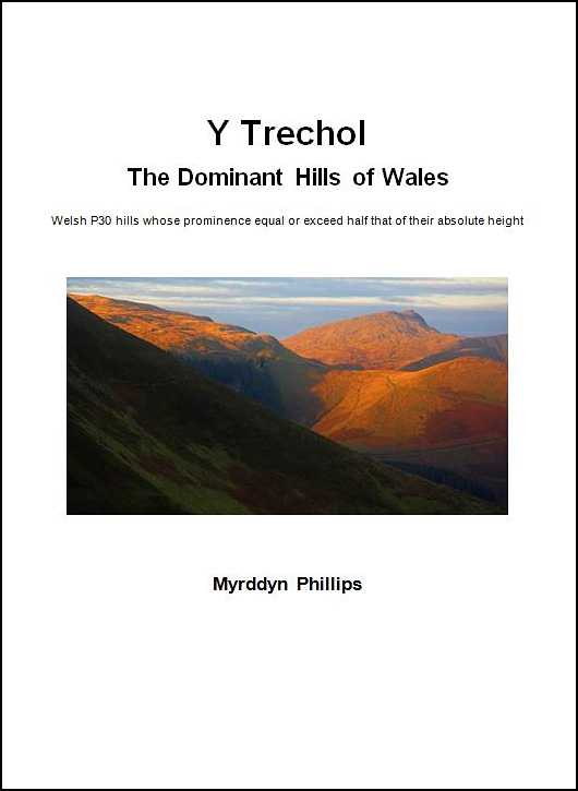
Y Trechol - The Dominant Hills of Wales - These are the Welsh P30 hills whose prominence equal or exceed half that of their absolute height. With the criteria for Lesser Dominant status being those addition Welsh P30 hills whose prominence is 33% or more and below 50% of their absolute height.
 |
| Upper Park (SJ 189 052) |
 |
| Extract from the Ordnance Survey Interactive Coverage Map hosted on the Geograph website showing the summit position in relation to the spot height position |
 |
| The Trimble GeoXH 6000 gathering data at the summit of Upper Park with the position of where the 352m spot height appears on the ground in the frosted field in the centre background of this photo |
Mapping Mountains - Summit Relocations - Y Trichant
Cefn Bach (SO 002 372) - 1st summit relocation
1st Survey post for Cefn Bach
2nd Survey post for Cefn Bach
There has been a de-twinning of summits that is being detailed as a Summit Relocation initiated by a survey with the Trimble GeoXH 6000 in conjunction with LIDAR data analysed by Aled Williams, with this hill listed in both the Y Pedwarau and the Y Trichant, with the following details being retrospective as the Trimble survey that partly resulted in this summit relocation was conducted on 18th August 2015.
The Y Pedwarau comprise the 400m hills of Wales that have a minimum 30m of drop, accompanying the main P30 list are also a number of sub lists. Whilst the Y Trichant comprise the 300m hills of Wales that have a minimum 30m of drop with an accompanying sub list entitled the Sub-Trichant.
The survey with the Trimble GeoXH 6000 was conducted in the southern hills of Mynydd Epynt on a fine and bright day during a circuit of three hills, with the hill positioned between the small communities of Merthyr Cynog to the west and Lower Chapel to the east south-east.
The two summits are easily accessed from a narrow lane to their south where one car can be squeezed onto the grass verge. This ascent requires a there and back walk, alternatively a similar there and back walk can be taken from a lane to the north-west of the northerly summit.
 |
| The Trimble GeoXH 6000 gathering data at the southerly summit (SO 002 372) which in conjunction with LIDAR data de-twinned the two 391m map heighted summits of Cefn Bach |
No comments:
Post a Comment